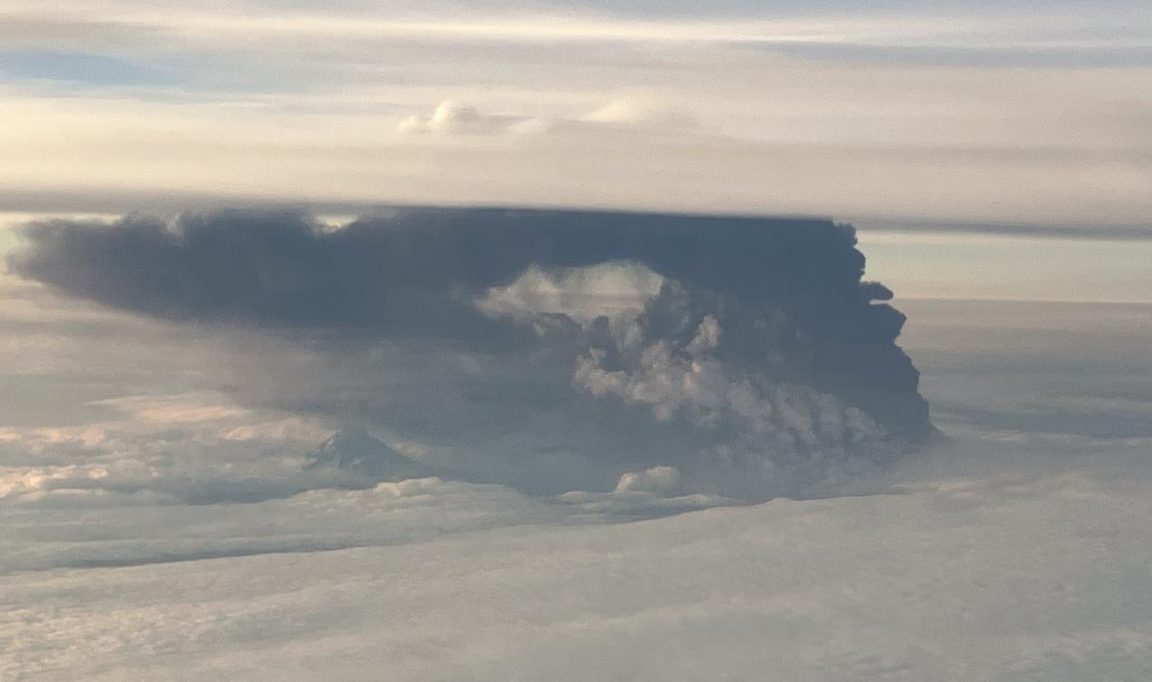
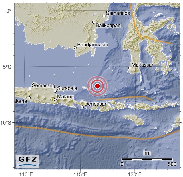
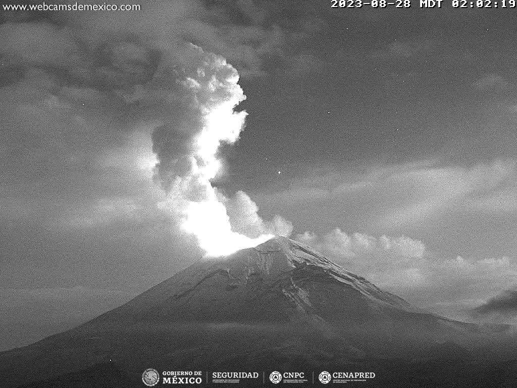
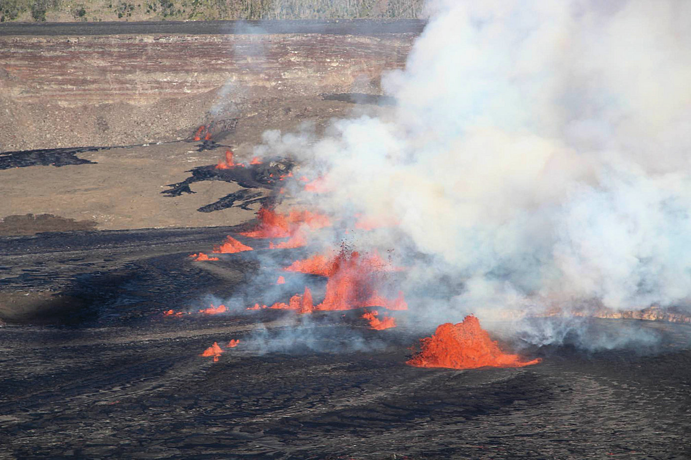
 Yesterday afternoon, the Kilauea volcano erupted again. It started around 3:30 PM Hawaiian time when a 1400-meter-long eruption fissure opened in the summit caldera. It cut across the Halema’uma’u Crater and even intersected one of the blocks in the caldera that had subsided during the 2018 eruption. During the initial phase, lava fountains up to 50 meters high were produced. The lava quickly spread in the Halema’uma’u Crater, creating a large secondary lava lake that now covers most of the crater floor. An area noticeably higher than the rest of the flat crater floor remains uncovered. This area was active during the recent eruption and was built up by several layers of lava. Most of the activity along the eruption fissure has since ceased, with the majority of lava now bubbling up from a partial rift near the base of the crater wall, and some lava appears to be welling up in the opposite sector of the rift.
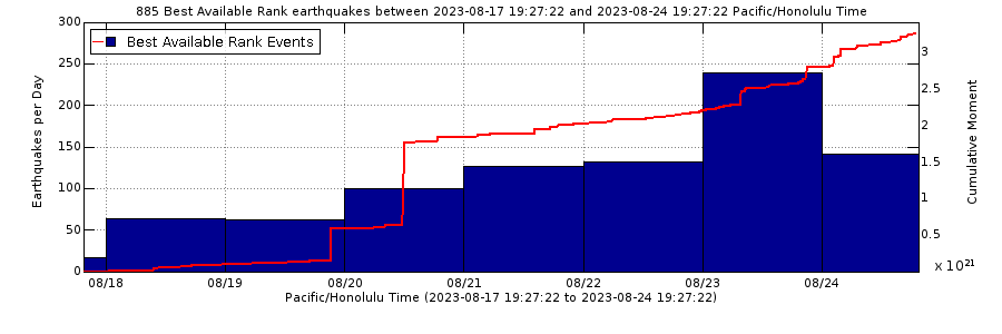
The volcanic eruption was not unexpected. For several weeks, there had been a significant increase in seismic activity, with daily records of between 150 and 200 minor tremors, primarily concentrated in an area south of the caldera. There were periods of significant ground uplift, which had subsided in the days leading up to the eruption. During that time, the magma that is erupting now had accumulated in a magmatic conduit.