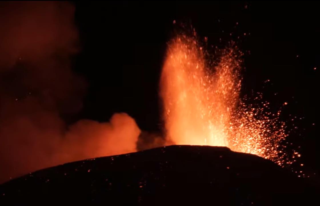
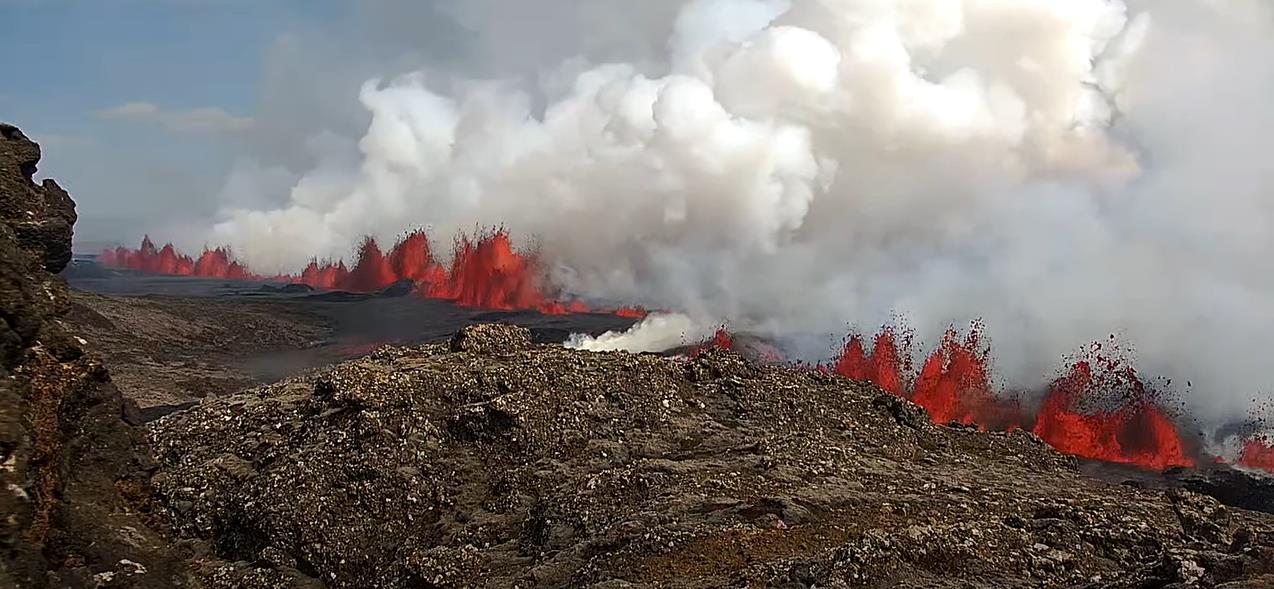
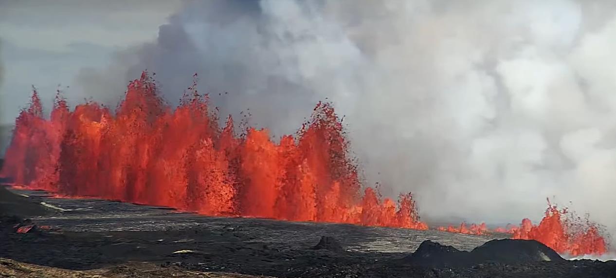
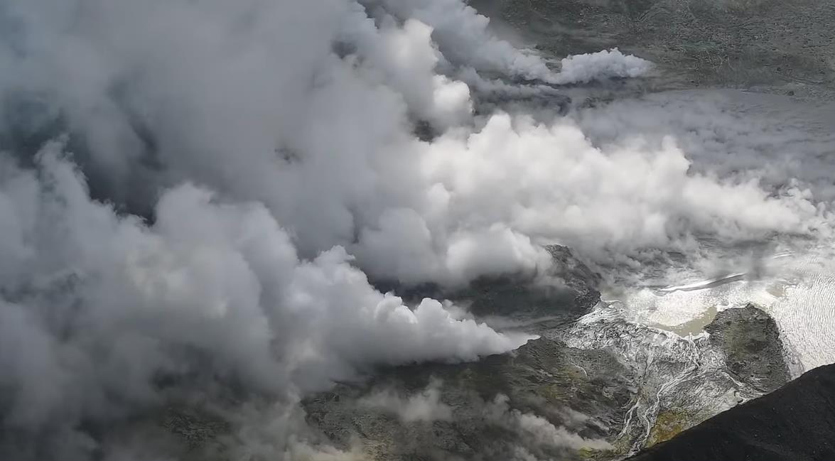
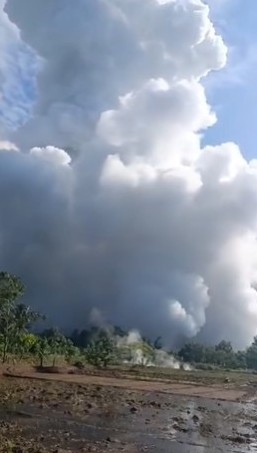
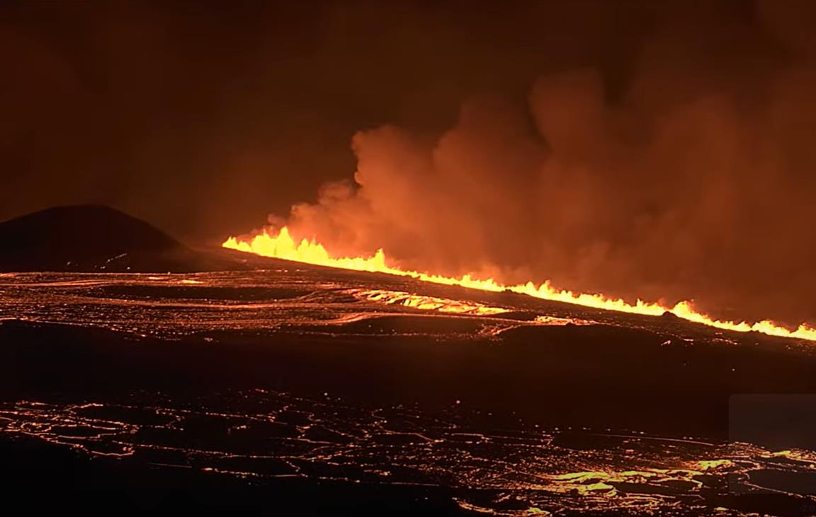
Last night, the sixth paroxysm in a row occurred at Mount Etna’s Voragine Crater on Sicily. By late afternoon, Europe’s highest volcano had already begun to intensify its activity. In the evening, the paroxysm became unstoppable and culminated in an impressive lava fountain. The peak of the eruption was only reached after midnight. The VAAC reported volcanic ash reaching an altitude of around 9,000 meters. Due to winds at different altitudes, the ash drifted both southeast and southwest. The latter ash cloud carried tephra towards Catania, where the airport was heavily affected by ashfall and had to be closed. Flight operations are expected to remain suspended until 6 p.m. today.
Marc Szeglat
Stromboli with pyroclastic flows into the sea
Intense lava overflow triggers pyroclastic flows on Stromboli – volcano blanketed in ash
This evening, Stromboli experienced several pyroclastic flows in quick succession. The activity started at 16:18 UTC (local time plus 2 hours) and continued for at least 45 minutes. The pyroclastic flows not only reached the coast but also extended several hundred meters into the sea. The live cam showed a large part of the volcano blanketed in ash. The ash moved toward Stromboli town, reaching an altitude of at least 2000 meters above sea level.
Etna. Paroxysm from Voragine
Etna experiences a paroxysmal eruption from the Voragine crater, sending volcanic ash several kilometers into the sky.
In the afternoon, Strombolian activity at the Voragine summit crater escalated into a paroxysmal volcanic eruption. By 17:00 UTC, the VAAC Toulouse had recorded volcanic ash reaching an altitude of 4,600 meters. At that point, the eruption was still intensifying. The ash cloud is currently expected to rise significantly higher. The air traffic alert status has been upgraded to “red.” The volcanic ash drifted southeast, away from Catania airport, but flight operations could still be affected.
Merapi with pyroclastic flow in May
Merapi Generates Pyroclastic Flow
The Indonesian volcano Merapi (Java) generated a pyroclastic flow this morning. According to BPPTKG, the dense flow traveled a distance of 1000 meters, making it one of the smaller events of its kind. The flow was caused by a collapse at the southwest dome and moved through a ravine near Kali Bebeng.
The pyroclastic flow was recorded at 05:31 WIB, producing a seismic signal with a maximum amplitude of 65 mm that lasted approximately 110 seconds. In the first six hours of the day, 16 rockfall events were also recorded, some consisting of glowing tephra that left luminous trails on the volcano’s flank. Long-exposure photos often give the impression of lava flows due to these glowing trails.
Overall, Merapi’s seismic activity has been low over the past two days. However, there was a small peak on May 27, with about 50 volcanic tremors recorded. This fluctuation in seismic activity is characteristic of the volcano’s behavior in recent months, suggesting periodic light dome growth.
Lava flow close to Grindavik at Iceland
Lava flow along the protective walls at Grindavik
The eruption that began this afternoon in Iceland is ongoing, although it has significantly weakened after a very intense initial phase. Nevertheless, a substantial amount of lava is still flowing, reaching the protective barriers northeast of Grindavik. These barriers have successfully redirected the fast-moving lava, causing it to flow around the town along the earthen fortifications that semi-circle Grindavik. The lava reached the western outskirts of the town, where the antenna installation is located, which is also protected by an earth wall. The lava flow is relatively close to the coast, and an ocean entry is not ruled out. The lava crossed the main road between Thorbjörn and Grindavik, cutting it off for the third time. This is the fifth eruption in the series.
The Icelandic Meteorological Office (IMO) has released initial data on the event. The total length of the main fissure was 3.4 kilometers, with its southern end reaching approximately 1 kilometer from the protective barriers northeast of Grindavik. The initial lava output rate was about 2000 cubic meters per second. Another fissure segment opened west of the most recently active crater from the March 16 eruption, with a reported output rate of about 1000 cubic meters per second. Preliminary data suggest this was the strongest initial phase of the eruptions in this series.
The southern end of the main fissure has now almost ceased its activity. In the final phase, a series of explosions occurred, expelling light brown ash from fragmented older lava, along with fresh tephra and steam. Gas pistons may have formed as the magma conduit emptied. It is also possible that groundwater came into contact with lava, causing the explosions.
New Volcanic Eruption in Iceland
New Volcanic Eruption in Iceland: Kilometers-Long Fissure at Sundhnukur
Following a brief seismic activity, the anticipated volcanic eruption in Iceland has begun. At 12:46 PM local time (14:46 CEST), a new fissure opened in the Sundhnukur crater row, with its full opening possibly not yet complete. Over several kilometers, lava fountains are shooting into the sky, accompanied by strong steam emissions. The event can be observed in clear weather via various live cameras.
So far, the fissure has reached a length of about 2500 meters. According to the Icelandic Meteorological Office (IMO), it is continuing to grow and extending southwards towards Grindavik. The lava fountains are reaching heights of 50 to 60 meters.
The fissure runs through the most recently active crater in the Sundhnukur row. As it grew through this crater, a lava fall formed over the flank of the approximately 30-meter-high cone.
The fissure opened at a point south of the crater, which was visible in the live camera footage and had been notable for persistent steam emissions since the end of the eruption on May 9.
The lava fountains are feeding a broad lava flow, initially spreading perpendicular to the fissure in an east-west direction. A large amount of fast-flowing lava is being produced, posing a renewed threat to Grindavikurvegur, which could be interrupted. The Svartsengi geothermal power plant might also be reached by the lava.
Phreatic Eruptions at Gunung Suoh Volcano
Three unexpected phreatic eruptions occurred in the Nirvana crater of Suoh volcano on Sumatra, Indonesia, yesterday morning at 8:30 a.m. WIB. The PVMGB of the Indonesian Volcanological Observatory reported that the eruptions produced dense, pure white steam clouds that rose up to 500 meters high and spread widely.
VSI volcanologists advised residents to maintain a minimum distance of 500 meters from the crater and avoid lowlands and river valleys due to the potential spread of volcanic gases, particularly carbon dioxide. This gas is heavier than air and can accumulate in low-lying areas, posing a risk of suffocation.
Gunung Suoh, also known as Mount Suwoh and Pematang Bata, is located in the Barisan Selatan National Park in the Lampung Special Administrative Region of southern Sumatra. Although Suoh is relatively unknown, it lies just 150 kilometers from the more famous island volcano, Anak Krakatau.
Another earthquake swarm rattles Campi Flegrei
After several relatively calm days, an intense earthquake swarm resumed yesterday evening beneath the southern Italian Caldera Campi Flegrei. Within 24 hours, around 160 earthquakes were recorded, more than in most weeks. The strongest tremor had a magnitude of 3.2 and was located 1.6 kilometers deep. Although the epicenter was within the hydrothermal system area, the strength of the earthquake suggests it was related to rock fracturing. Despite occurring during the volcano’s dormant period, there were reports of perceptions, even from the Sorrento area. The Shakemap shows increased weak earthquakes over a large radius, indicating accelerated ground uplift.
Four additional earthquakes had magnitudes in the range of two, with the strongest being 2.9. Interestingly, the stronger earthquakes clustered in the outer eastern flank of the Solfatara crater, near the Pisciarelli fumaroles, the area with the strongest geothermal manifestations of the Solfatara. As a result of the strong ground uplift in April, the gas temperature of the main fumarole briefly rose to 96 degrees but decreased to 94 degrees last week. Newspaper reports suggest that a magma body is accumulating at a depth of about 4 kilometers, which could lead to a volcanic eruption quickly in the event of a crack in the caldera’s cover rock.
Ruang: Strong eruption in Indonesia
Strong explosions shook the Indonesian volcano Ruang, resulting in pyroclastic flows and volcanic thunderstorms. An ash cloud reached a height of 19 kilometers and spread southwestward, even reaching Sulawesi, where the International Airport of Manado had to be closed. Strong volcanic thunderstorms accompanied the eruption clouds, accompanied by thousands of lightning strikes. Pyroclastic flows flowed down the volcano in all directions, reaching the sea. Footage showed burning houses on the island, which had already been evacuated. It is unclear if there were any casualties.
The warning time was short, with a rapid increase in volcano-tectonic earthquakes the day before the eruption. The earthquakes began at depth and shifted towards the surface with ascending magma. A exclusion zone with a radius of 7 kilometers was established around the crater. The main explosions generated seismic signals with a maximum amplitude of 55 mm and durations of 360 and 600 seconds. The alert status is “Red”.