Pacaya increases activity on 26.09.20

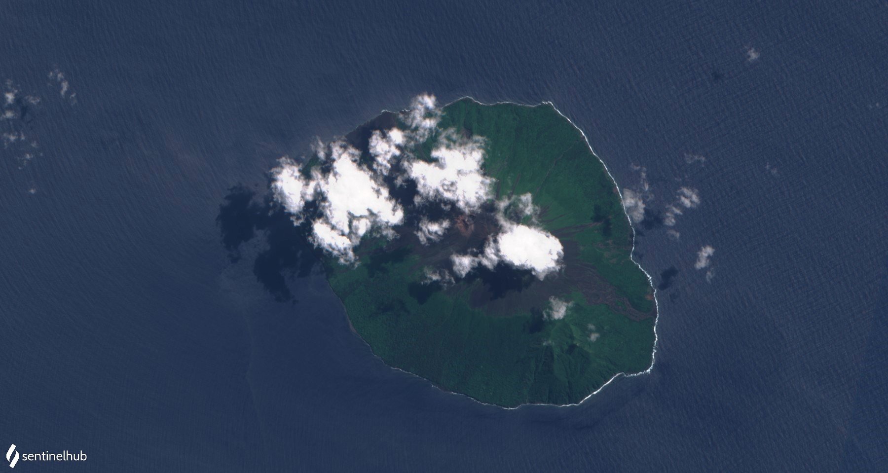
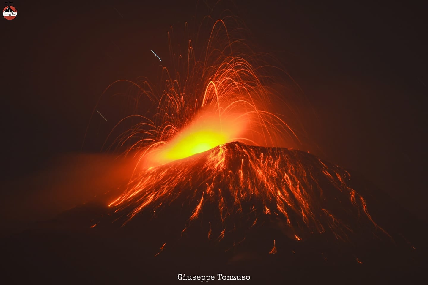
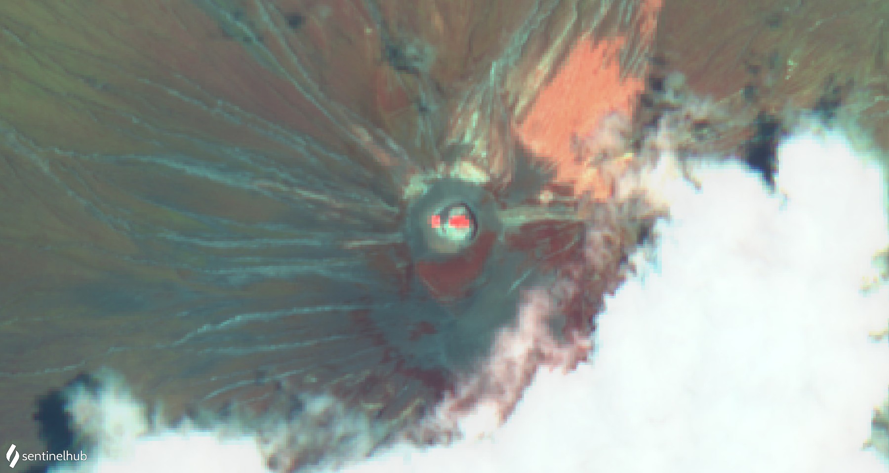
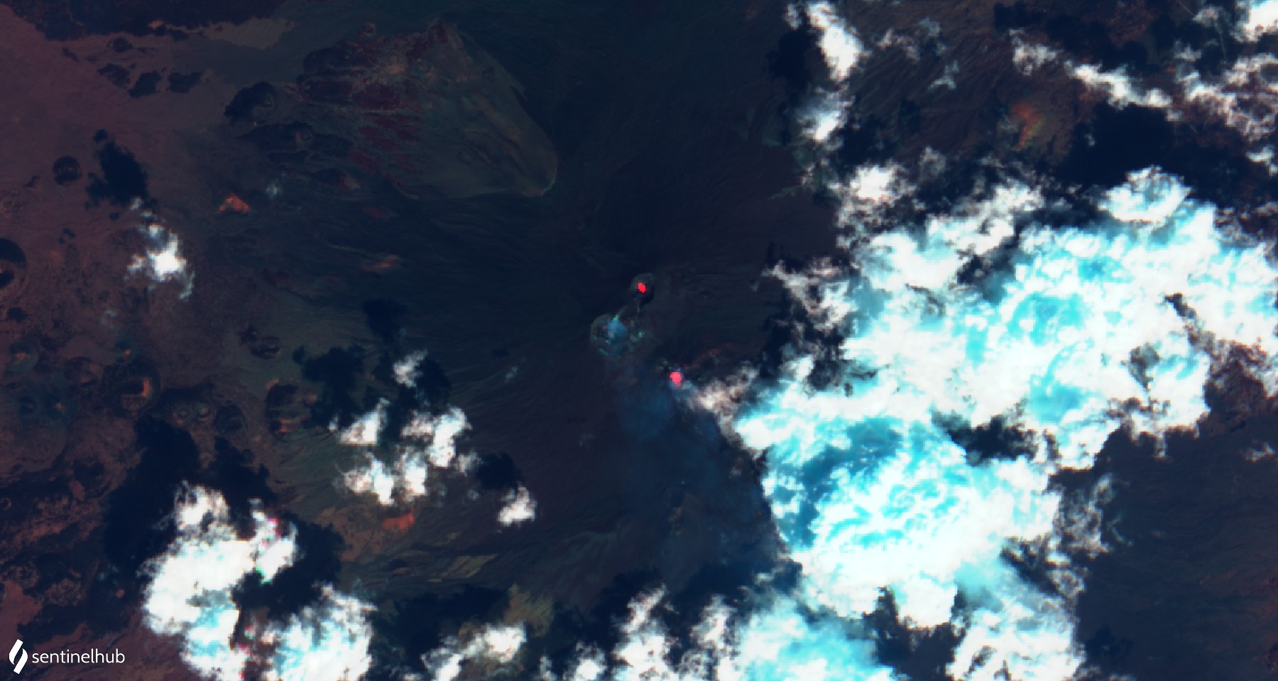
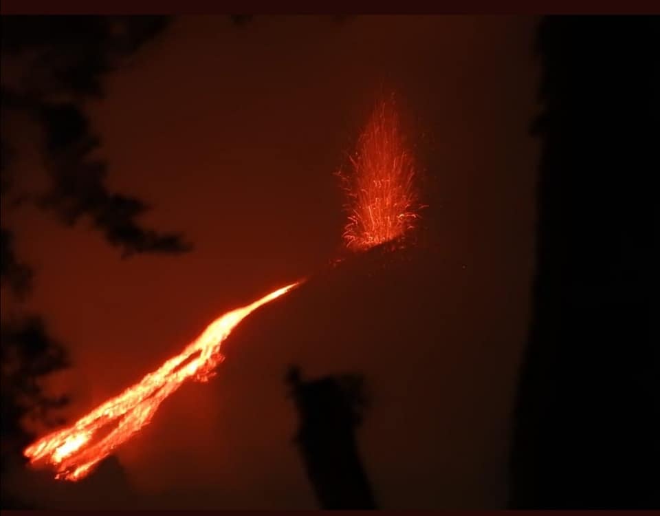
Yesterday evening there was a sudden increase in activity at the Guatemalan volcano Pacaya. Strombolian eruptions came in short intervals and transported glowing tephra up to 70 m high. A new lava flow began to flow again, which quickly covered a distance of 200 m. The activity was accompanied by tremors. A few hours earlier INSIVUMEH reported strombolinaceous eruptions, but not an active lava flow.

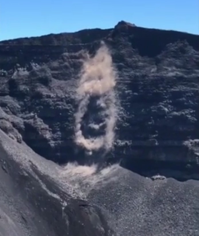
During my visit to the volcano in January of this year I also witnessed how quickly the situation at Pacaya can change: suddenly a vent on the south side of the Mc Kenney cone opened and produced a short lava flow. A little later a flow on the north side became active. After a few minutes everything was over again. Such events illustrate the unpredictability of volcanoes.

Lopevi: Warning of volcanic eruption

The Vanuatu Department of Meteorology and Geohazards (VMGD) yesterday warned of a possible impending eruption of the Lopevi volcano. The reason for the warning is a significant increase in seismicity under the volcano. Vapor emissions are observed. The alert level is 2/5 and an eruption can occur without further warning. It is recommended not to go to the edge of the crater. The image shows the current seismogram. In Vanuatu only the Yasur is active at the moment.

Seismic drumplot. © VMGD

Etna: Increasing activity

Etna in Sicily increased its seismic and eruptive activity. Already on Wednesday there were several earthquakes near the central crater area. The quakes are only now being reported to the INGV, indicating magma movements. A total of 13 earthquakes were registered. 7 of the quakes can be attributed to a swarm that started at 22:20. The strongest earthquake had a magnitude of 2.9. 0 m is indicated as the depth of the focus. The epicenter was east of the northeast crater. The other quakes of the swarm manifested themselves in a few hundred meters depth.
The tremor fluctuates strongly and phases of strombolian eruptions from the New Southeast Crater occur again and again. Mountain guides report loud explosion noises.

Piton Fournaise: Increase in earthquakes

Since September 20, the volcanic earthquake activity under the Piton de la Fournaise has been increasing. Within 2 days 21 weak tremors were recorded. They had maximum amplitudes of 1 and were located at depths between 1.7 and 2.2 km. The epicenter manifested itself under the summit crater Dolomieu. There, on Monday, the release of a debris avalanche was also documented. Whether there is a connection with the earthquakes is unclear. Possibly, inflation also played a role, because a swelling of the summit area was detected at the same time as the quake activity increased. Furthermore, the carbon dioxide concentration of fumaroles increased. The evidence suggests that magma is rising and filling the uppermost magma reservoir. Sooner or later a new eruption will occur. The last eruptions usually took place 3-4 weeks after comparable signs became known.

Hasan Dağı: Gas emissions after earthquake

An unusual report from Turkey combines earthquake with volcanic activity. On Sunday, it shook in the border area of the provinces Aksaray and Niğde with a magnitude of 5.3. The epicenter was located 23 km northeast of Emirgazi. The epicenter of the earthquake was only 3 km deep. Almost 30 km northwest of the epicenter is the volcano Hasan Dağı. With a height of 3.268 m it represents the 2nd highest elevation of Central Anatolia. Videos make the round by the social media, which developed after the earthquake and show gas leaks. Apparently they are new fumaroles that have formed near the summit crater. A team of geologists will now take gas samples and analyze them. Gas eruptions occur repeatedly after earthquakes and need not be related to volcanism. On a volcano, however, one can assume that they are probably magmatic gases.

Fuego with vulcanian explosions

INSIVUMEH volcanologists describe the explosive activity on the Fuego as moderate to strong. Between 12 and 16 Vulcanian eruptions are generated per hour. They cause volcanic ash to rise to a height of 4900 m above sea level. The ash clouds drift westward and cover distances of up to 15 km. Glowing tephra is ejected several hundred meters above crater height. Glowing debris avalanches are created which flow off through the various drainage channels. On a 2 day old satellite photo you can still see a lava flow flowing south. In the current Bulletin there is no more talk about it.

Ol Doinyo Lengai with heat signature

The volcano in the East African Rift Valley is still active. This is confirmed by a heat signature captured by MIROVA and Sentinel. Mirova indicates a thermal radiation of 6 MW. Sentinel images in the infrared spectrum show 2 thermal anomalies. One emanates from the central crater area where a large hornito recently grew. Another hotspot formed on the southwestern crater rim. If you look closer at the photo you can see black lava flows flowing along the crater rim and flowing into the central area. Layer by layer the pit crater is filling up again and with a little luck it could be accessible again in a few years.

The only question then is how we will travel to and in Africa? Thanks to the Corona Pandemic, we are probably at a turning point. The airlines are mothballing more and more planes and laying off staff on a grand scale. Even if the pandemic becomes manageable thanks to vaccination, it will be years before we are even close to pre-pandemic levels of travel technology.

Etna: Northeast-Crater is active

Etna in Sicily erupts from 2 of its summit craters. Besides the known strombolian eruptions from the saddle vent of the New South East Crater, weak eruptions in the Northeast Crater have now been confirmed. A thermal anomaly in NE crater had been visible on sentinel satellite photos for some time. Now the mountain guide Gio Giusa climbed the crater and documented weak eruptions. They come from one of 3 small hornitos rising from the deep crater floor. Activity in the Northeast Crater was recently an indicator of a general increase in Etna’s activity. From here the activity often shifted to the central crater. This is currently quite quiet.

Sangay with strong eruption

Yesterday the sangay erupted very strongly. The eruption was explosive in nature and transported volcanic ash to an altitude of 50,000 feet, which is 15,240 meters above sea level. The VAAC reported the ash cloud at 12:59 UCT. In Ecuador it was 7:59 a.m. More explosions followed during the day, in which the explosions lost some of their force but still carried ash at more than 10,000 meters above sea level. At different altitudes, the air currents blew in different directions: The lower part of the eruption cloud was transported westward, the upper part eastward. This circumstance caused ash rain in 6 of the 24 provinces of the country. The regional airport of Guayaquil temporarily stopped its operations because the ash endangered air traffic. The country’s government promised to help the cattle ranchers to remove the ashes. It covers the pastures and contaminates the drinking water, not only for the cattle.

Los Angeles: Earthquake Mw 4,5

Yesterday morning, an earth tremor with a magnitude of 4.5 shook the greater Los Angeles area. The epicenter was 8 km east of Los Angeles. The depth of the epicenter was indicated by USGS as 18 km. According to the EMSC, the hypocenter was located at a depth of 20 km. In spite of the comparatively large depth of the focus, the earthquake was clearly perceived in the Los Angeles area. There are reports of small damages like cracks in house walls. Larger damages did not occur.

The earthquake manifested itself in the same fault zone as the 1987 Whittier Narrows earthquake, which had a magnitude of 5.9 and caused destruction in the city. The activated fault zone is the Puente Hills thrust fault, which is associated with the San Andreas Rift.

Translated with www.DeepL.com/Translator (free version)